Map: California public schools located in or near fire hazard severity zones
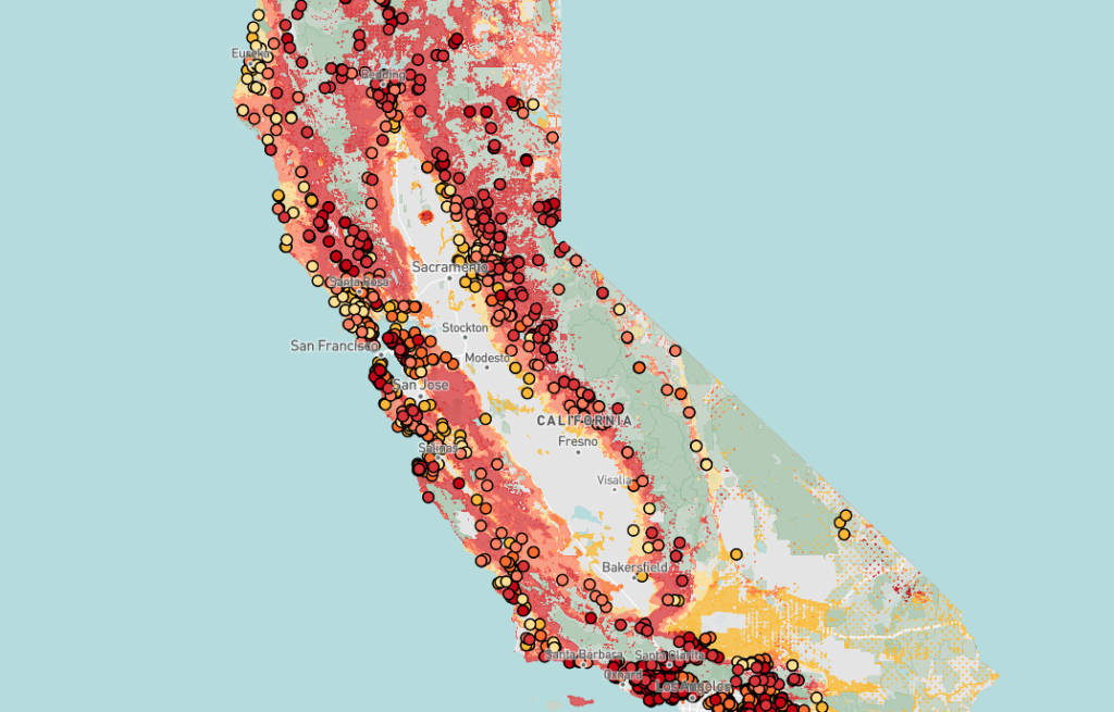
The Office of the State Fire Marshal (OSFM) classifies Fire Hazard Severity Zones as Moderate, High, or Very High, based on factors like fuel load, slope, fire weather, and wind patterns that increase wildfire spread. This classification reflects hazard, not risk — focusing on long-term wildfire behavior (30-50 years) without considering mitigation efforts like home hardening or fuel reduction.
Out of 10,591 public schools in California, 1,459 (13.7%) are located in or near Fire Hazard Severity Zones. Of those, approximately 70.7% fall within zones classified as High or Very High. Use the map to check whether your local schools are in these zones, and filter by Moderate, High, or Very High to explore further.
Data source: Cal Fire, the Office of the State Fire Marshal (OSFM) and EdSource data analysis